My, my, but I have some catching up to do.
I knew it was going to be tough getting blog pieces done, but rather thought I'd be more on top of it than this. I mean, I did the hike I'm about to report on simply ages ago.
What with the dive shop and the fish farm and... well, the dive shop and the fish farm, I've not had time to get out and actually do much, much less pontificate at length on matters in which I may feign expertise sheerly by virtue of my remote anonymity and linguistic panache.
But you, dear reader, don't come here to read about me (I wouldn't, don't feel bad); you come here to bask in the glory that is the Natural World in Hawaii. So onwards and upwards we go, speaking of being on top of things.
A few weeks past, the girlfriend and I took a wee ramble up a deceptively voluptuous-looking mound of cinder known as Puu Waawaa (many-furrowed hill, apparently), a vent cone on the north flank of Hualalai volcano. Forgive my lack of proper diacriticals, but they're damn'd cumbersome when typing. I'll just pull a Timothy Dexter and leave you a bunch of them here so you "may salt an pepper them as you please": `````````------.
The Puu is the main eruption site for one of the largest-volume flows on the island. At roughly 900 feet thick, the Puu Waa Waa/Puu Anahulu flow consists of some 5.5 cubic kilometers of lava. Heavy, man. Around 105,000 years old, the Puu is a trachyte dome, which I gather is a considerably unique feature in Hawaiian volcanism. Trachytic magma is lower in silica than most Hawaiian lavas, which are basalts, and higher in feldspar, potassium oxide, and a slew of other simply fascinating... er, rocks. This (apparently) makes it one of the only places in Hawaii where one could reasonably expect to find the volcanic glass Obsidian. Cool!
 |
| There she is, as viewed from the reserve entrance over the hood of the Range Rover. Doesn't look that bad, eh? |

After you drive through a couple of ranch gates, you come up to a hunter check-in station, which is where you dismount and begin the hike. Yes, this area is a wildlife sanctuary, but only for native species. All introduced hoof-critters, which can wreak singular havoc on native ecosystems, are emphatically on the menu, and subject to year-long open season. And a bag limit of, I kid you not: one goat, one pig, and one sheep. Per hunter. Per Day. Any mainland hunter could tell you how extraordinarily ruthless that seems on the part of the State, but they're serious about protecting this place, I guess.
Running past the check-in station is a long, straight, and increasingly steep paved path indicated as "Vulcanite Road" on the map-pamphlet available at the start of the hike. This road will take you up through scrubby grassland, scattered ohia and silk oak, a lot of cows, and eventually a decent patch of mesic dry forest before leveling out after a few miles at an old cinder-quarry camp at the base of the cone. There are a couple of other trails that zig and zag their way up to the old mine over rougher ground, complete with numbered landmarks corresponding to informational blurbs on the map. This gives a very national-parky experience. Having done that on a previous trip, we opted for the steeper but far more direct Vulcanite Road.


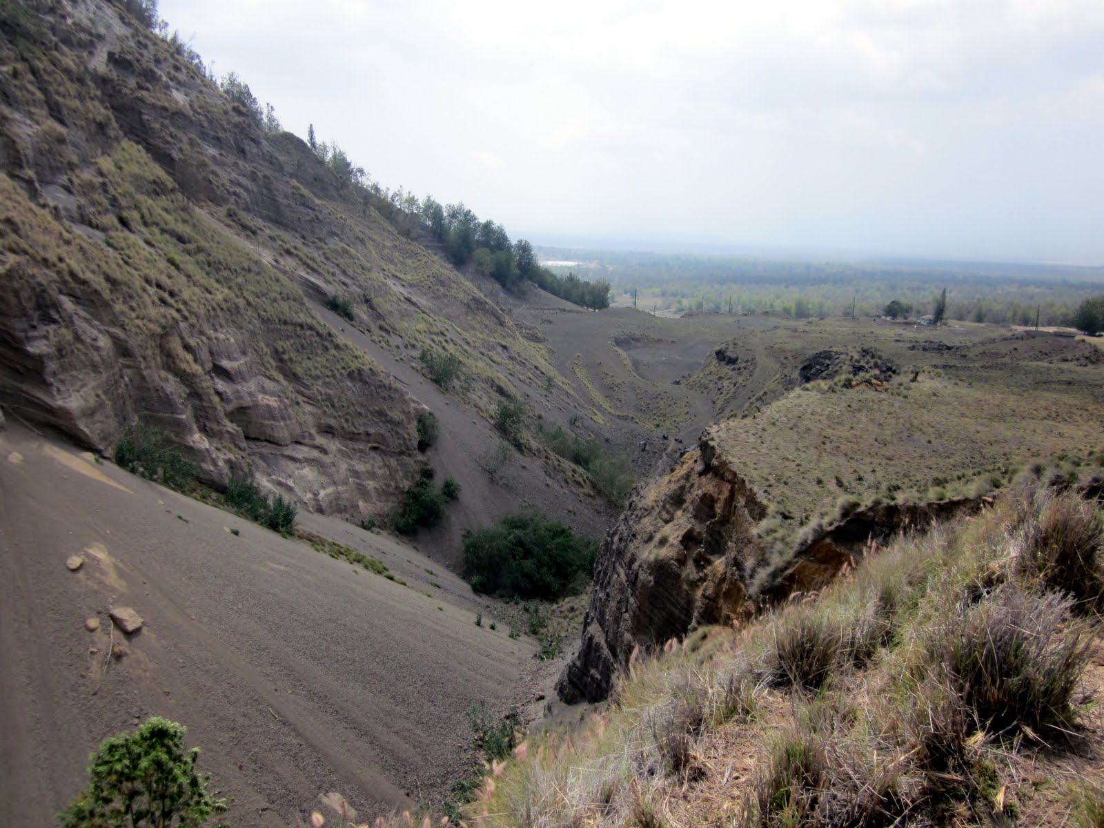
This side of the cinder cone was largely cut away for what looks like a fill-quarrying operation, leaving a massive cleft and scree flow behind.
There was a herd of goats, nimble and fleet of foot but of dubious intelligence, who ambled within a stone's throw of us while we rested here. When the dog noticed them , they bolted up the nearly-vertical cinder cliff face with an alacrity surprising for animals which had moments before displayed all the verve and incisiveness of four-legged compost barrels.
Continuing the ascent around the base of the cone's north flank, the trail climbs onto open pasture land with a good view of the surrounding Ohia forest. An old corral marks the spot where the trail deviates from the old ranch road network and heads up the side of the cone.

There's something wonderfully forlorn about these derelict old structures, something that begs photographing. For all the damage it's caused, ranching has been an integral part of life on this island since the first cows came ashore in the early 1800s. There were vaqueros here before the "cowboy" ever entered the american consciousness. The old cattle chutes and bunkhouses and other such artifacts you can still find scattered across the backcountry on this island, now falling into decay and rot, won't be here terribly long. I always feel compelled to take a few shots of these generally neglected pieces of Old-Hawaiiana.


At this point, we were getting impatient to gain some serious altitude and abandoned the trail altogether in favor of a direct hill assault. This is not something I recommend. Stay on the trail, it's there for a reason. Our route was extravagantly steep, prickly, and tiring. But the north flank offers some awesome views:


Underfoot, the spongy open turf on the side of the hill looks like it would be more at home on a Yorkshire moor than a Hawaiian volcano. It gets cold and blustery up here; Puu Waawaa bisects the saddle between the massive baulks of Hualalai and Mauna Kea, which acts as a funnel for compressed wind currents. Unlike the moors however, the terrain is so steep that some of the views give the impression of soaring.

As we neared the "summit", we noticed that we had committed an error in navigation by striding brazenly up the flank. The Puu actually consists of two cones, and we were on the shorter of the two. Thoroughly winded after our climb, we accepted the runner-up position and settled for a look around.


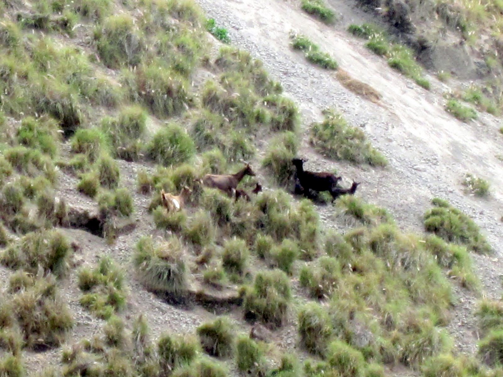
On the descent, we came across a herd of Mouflon sheep. Native to Asia Minor and the Caucusus, these guys were introduced to Hawaii as a game animal in the 1950s and have since caused much destruction in the islands' upland habitats. The sheep totally clearcut swaths of land, removing most vegetation and allowing massive soil degradation to take place. A magnificent creature to behold, sure, but a pest and one that needs periodic culling to keep populations under control. Hence the Caligulan bag limits. Despite this, they didn't seem too perturbed by our presence.


We eventually came down and around the east flank and joined up with the route we had left behind, retracing our steps downslope as the late afternoon clouds blew in across the saddle between Hualalai and Mauna Kea. All in all the hike as we did it was a round trip of about 8 miles, with an elevation gain of about a thousand feet, most of which is in the last couple of miles. It's beautiful country back there and, while easily accessed, gives a good feel for what the island's mostly uninhabited interior is like.
There are loads more pictures of the area's flora and fauna to be seen on my facebook page for those of you who are interested. Hope somebody finds this helpful, or at least mildly entertaining. If you're planning a hike here Google-Earth it first and you can get a better idea of what I've been rambling on about. I will leave you with a visual representation of the hike's strenuousness, using my patented Jack Russel Terrier Scale of Knackeredry (ranging from "Still Frothing Mad" to "Abruptly Comatose"):

As you can see, Stella here gives the hike a tongue-lollingly strenuous mark of "Well Shagged Out".
That's it for now then. Later on, expect a write up on a motorcycle trip from Kailua to North Kohala, and a step-by-step guide to the dissection of a Borg-Warner 4x4 transfer box. Scintillating stuff, I know.